Very popular ski tour that has, as a completion, the descent of Libro Aperto peak (north-east face) on one of the nicest northern Appenines slope where snow usually keeps a good quality. You have to bargain for the low section in the wood which is a bit annoying.
The Libro Aperto belongs to the Cimone group, (whose is a subgroup), to whom it’s connected by a secondary ridge passing through Lagoni peak . Its name comes from the two peaks (Belvedere – 1896m and Rotondo, the main summit – 1937m), connected by 2 slopes laying in a way that they seem the pages of an unfolded book (unfolded book=libro aperto).
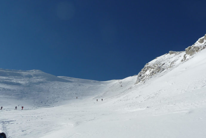
This is a very popular ski tour that, in its low section passing through the wood, can give some bearing problems; the upper beautiful north-east slope gives a pleasant descent that rewards of the difficulties of the first part. You can stop at the saddle between the main (1937m) and the secondary peak (1932m) otherwise you can get to the top in two ways: 1) traversing the north-est slope, bypassing the summit, getting to the ridge and then climbing on the main peak; 2) directly climbing on the top, carrying your skis on the backpack with a short alpinistic sequence (chain).
The trip
We started on skis from Casulie di Fellicarolo (1072m) and went uphill in a 30 cm soft snow covered landscape. The road that reachs Taburri di Fellicarolo hamlet (1232m) was not snowploughed yet. After having got to that hamlet, we kept climbing going through a long tiring wooded section then finally on free slopes: up to Pizzo Sassi Bianchi peak on soft snow. After then, wind blown snow forced us to set ski crampons. We got to the saddle under the main Libro Aperto peak (1937m). The weather was nice, although, particularly on the ridge, it was very cold. The descent was without problems on an acceptable snow quality.
I did this itinerary with Ski touring Group “A. Bafile” – Italian Alpine Club, Section of Florence.


HIGHLIGHTS
Start: Casulie di Fellicarolo (MO)
Date: 23rd Jan 2011
Height difference: +850m
Time: ascent 2h50′
Difficulty (Blachere scale): BS
Maps: “Alto Appennino modenese” – carta dei sentieri 1:25.000 (2006) ed. Selca – Firenze o “Appennino modenese, Garfagnana” (18) 1:25.000 ed. Multigraphic – Firenze